Last month on a Saturday following a business trip to Monterey, California, our host took us on a walk at Point Lobos State Reserve, some 550 acres of shoreline and over 5 square miles of submerged reserved lands at the northernmost reach of “el pais grande del sur” (much better known nowadays as Big Sur):
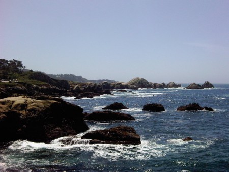
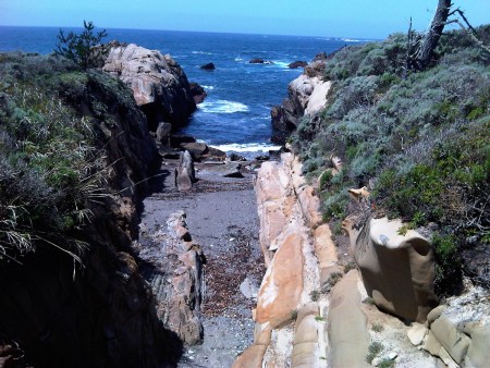
And it’s probably, at least to my mind, the most beautiful place on the planet, as you can see from the aforelinked photos. This cellphone snapshot of mine uglies it up somewhat, but, well, you get the idea:
We went to the southernmost portion of the reserve and hiked a gentle cliffside trail overlooking some extremely rugged, but incredibly beautiful, terrain. (We could have chosen from several more challenging hikes, but we didn’t want anyone to get tired or hungry or lost or cold or…)
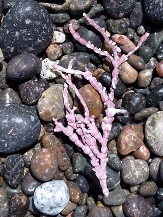
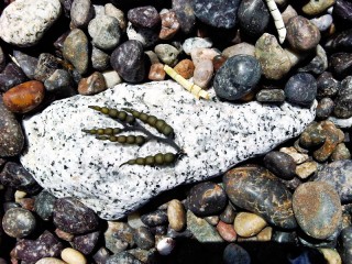
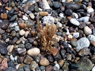
Our first stop was at Hidden Beach, which is entirely made of wave-rounded pebbles. Small bits of marine plants show up in the wrack; here are a few I thought were worthy of note, even if I can’t provide more than a rudimentary id on them:
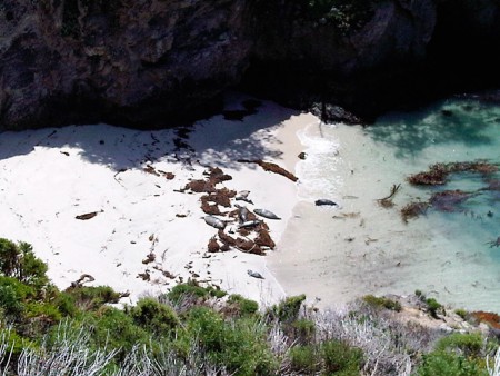
The next stop on the itinerary was the sand beach at China Cove, a popular sunning spot for tourists and locals alike. But if you visit during April or May, as we did, you might find that there’s no room on the beach for you! Because that’s when the local harbor seal (Phoca vitulina) population takes over, using the beautiful protected cove as a hauling-out beach and nursery:
The staircase is cordoned off during this delicate time, so we enjoyed the scene from the cliffs overlooking the cove. We saw pups frolicking in the water and sunning on the beach, trying to get their lazier (smarter?) parents to pay attention to them and come on and swim! Harbor seal pups require only a few weeks of maternal care before they are on their own in the cold, rich waters of Monterey Bay and environs.
From there, our group split up; some of us went on the Bird Island clifftop trail to get views of the water and beaches, while others went on to the wide sands of Gibson Beach. Both parties thought they got the better deal…
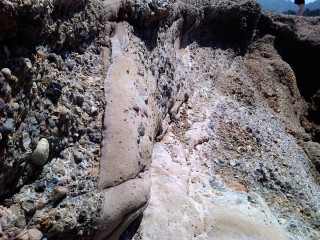
Big Sur is one of a few places in the world where relatively high mountains meet the ocean abruptly. The geology of the area must be fascinating to those who understand more of it than I do. I’ve just read the chapter on geology in the Natural History of Big Sur, but without a better background in the subject I’d only lead you astray if I were to do anything more than show you a picture of this conglomerate rock:
I conjecture that this is part of the Carmelo formation, based on this helpful description from the map/brochure:
Two contrasting rock types dominate the Reserve. The Santa Lucia granite, igneous rock that solidified underground about 80 million years ago, makes up the craggy landscape of much of the north shore, while the terrain of Sea Lion Point, the south shore, and Whalers and Moss Coves are comprised of the Carmelo Formation, a sedimentary rock at least 55 million years old. This more easily eroded conglomerate is recognized by its bumpy collection of water-rounded rocks deposited by ancient avalanches that occurred in an underwater canyon.
[For more on the millions of years of uplift that brought underwater canyons to the clifftops, see my comments on last year’s visit to Montana de Oro State Park in San Luis Obispo county.]
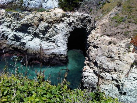
Over countless years the Pacific has carved out many small islands in the Big Sur. They begin as natural bridges, like this one that connects China Cove, where the harbor seals were hauled out with their pups, to Gibson Beach and Bird Island:
For comparison purposes, here’s a natural bridge forming in the Anastasia Formation on Florida’s East Coast. As you can see, it’s on a much smaller scale:
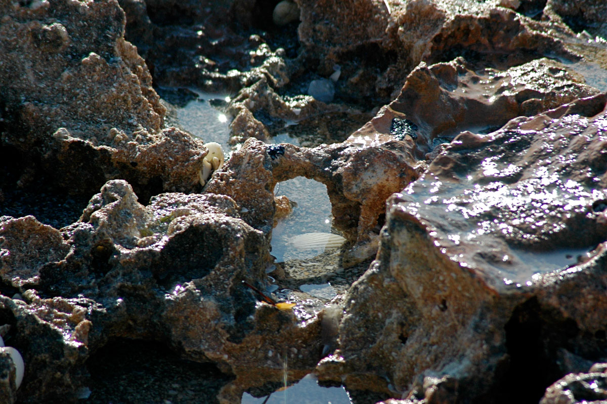
Presumably Bird Island was connected to the mainland at some point by a similar bridge that has since crumbled into the ocean below, victim of the combination of brittle granite and relentless saltwater intrusion and pounding surf. With the isolation from the mainland comes a separation from terrestrial predators, making this and other islands in the area into perfect rookeries for seabirds. If you come at the right time of year (I didn’t), you can find hundreds of Brandt’s cormorants nesting on the large flat island.
As at Montana de Oro State Park, Point Lobos has plenty of wavecut inlets to explore when the tide is right:
I look forward to the day when I can arrange an extended trip to this area, complete with real photo gear and a picnic lunch!
